Start Slideshow


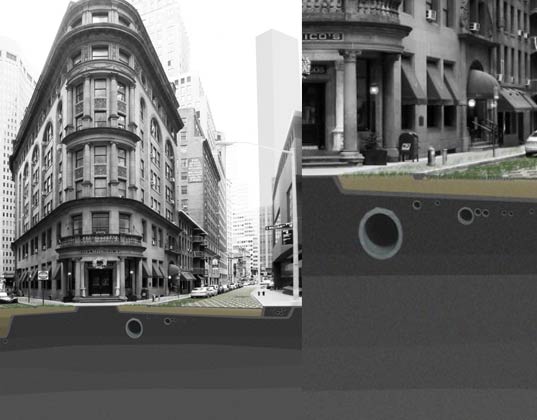

 The city landscape will change drastically when the water arrives.<em>This article was originally published on March 2, 2010.</em> <p> It's long been known that if the <a href="http://www.inhabitat.com/2009/11/21/a-haunting-visual-prediction-of-our-flooded-future-world/">seas rise</a> due to <a href="http://www.inhabitat.com/2010/03/01/al-gore-attacks-climate-change-skeptics-political-inaction/">Climate Change</a>, <a href="http://www.inhabitat.com/nyc/">New York City</a> is in trouble. With buildings built right up to <a href="http://www.inhabitat.com/2010/01/11/renovated-sugar-refinery-to-provide-sweet-new-homes-in-brooklyn/"> the waterfront</a>, the city could be in a soupy mess with just a small increase in water levels. Enter the <a href="http://www.inhabitat.com/2009/07/16/axis-mundi-unveils-alternative-design-for-moma-tower/">Museum of Modern Art</a>. Eight months ago they commissioned 5 teams of designers and architects to take up residency and create real world solutions for the Big Apple. On March 24th the exhibit <a href="http://moma.org/visit/calendar/exhibitions/1031">"Rising Currents: Projects for New York’s Waterfront,”</a> goes on display.1
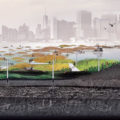 The new view from the oyster farms imagined for the Gowanus canal.The project was sparked by <a href="http://www.inhabitat.com/2009/12/15/nyc-mayor-bloomberg-looks-to-danish-offshore-windfarms-for-inspiration/">Mayor Bloomberg's</a> announcement last February of the report by the <a href="http://www.inhabitat.com/2010/02/24/new-york-city-share-a-cab-with-a-stranger-to-save-emissions/">New York City</a> Panel on <a href="http://www.inhabitat.com/global-warming/">Climate Change</a> that predicted that <a href="http://www.inhabitat.com/2010/02/23/future-downtown-brooklyn-citypoint-mall-seeking-leed-silver/">New York City</a> would quickly sink under water if sea levels rise. "Rising Waters" was initiated by the Latrobe Team, a multi-disciplinary Princeton University affiliated group led by Professor Guy Nordenson, a structural engineer. The project is meant to create real <a href="http://www.inhabitat.com/2010/03/01/1000-duany-shelters-to-be-donated-to-haiti/">adaptive solutions</a> for New York city and New Jersey.2
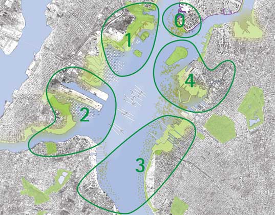
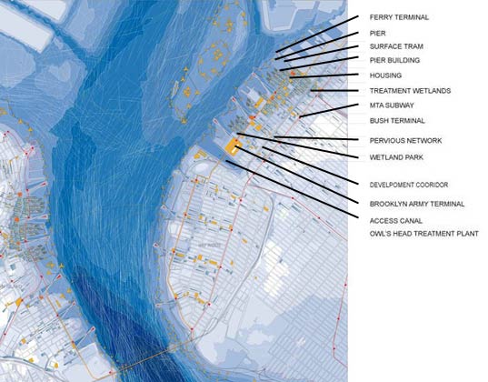
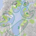 There were five areas of focus, one for each design team.The teams chosen by MOMA to explore the problem took up shop at P.S. 1 -- <a href="http://www.inhabitat.com/2010/02/10/bigs-cloudscape-for-ps1-can-be-recycled-into-messenger-bags/">the MOMA satellite in Long Island City</a> -- in November. They were each given an area of New York or New Jersey to focus on.3
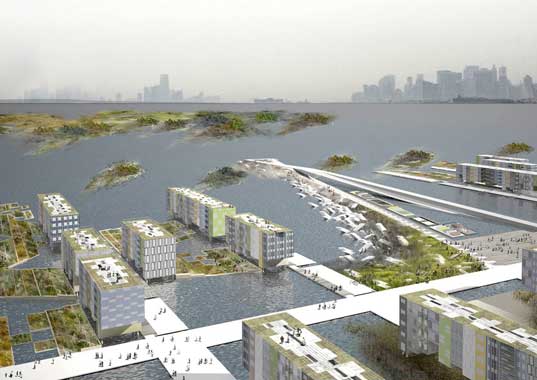
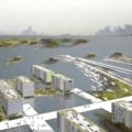 A canal city is imagined for Sunset Park, Brooklyn.Some of the ideas took advantage of what high ground there is in New York City. This rendering is of Sunset Park, Brooklyn in a new age Amsterdam. Canals instead of roadways connect the buildings by water.4
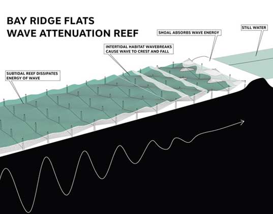
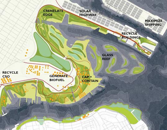
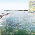 The Bayonne oil towers are re-imagined as a garbage proccessing station.Other teams decided to focus on rising waters and the issues of tidal waves. Recycled glass bottles are used in this rendering to create an artificial reef to decrease the force of the waves as they come in from the ocean.5
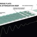 A mockup of the artificial glass bottle reef in New Jersey.A rendering of the reef shows how it blocks the waves from gaining force as they move toward the city.6
 Underground pipes divert water from the city.Some of the renderings were of more immediate solutions. This one shows how pipes can be inserted under roadways and sidewalks to divert water away from the city.7
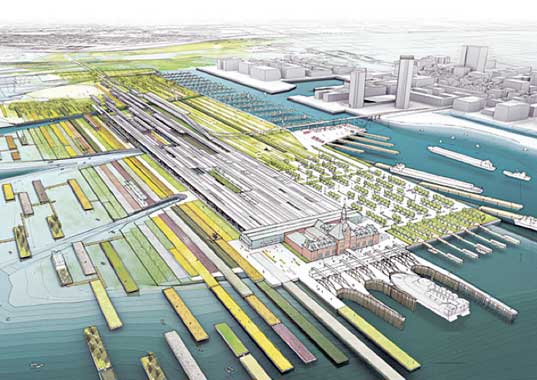
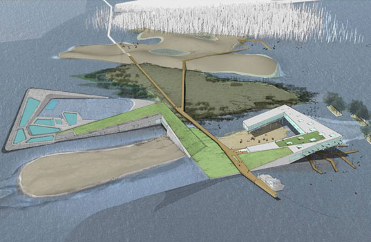
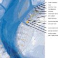 A new municipal plan is drawn to keep business running as usual.Municipal plans were drawn up by one of the teams to show how New York City could restructure its neighborhoods to be water focused instead of road focused.8
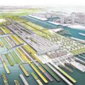 Floating land masses replace those covered by the sea.Floating buildings were one solution provided. This rendering of New Jersey shows how new rectangular structures could replace land lost to the sea.9
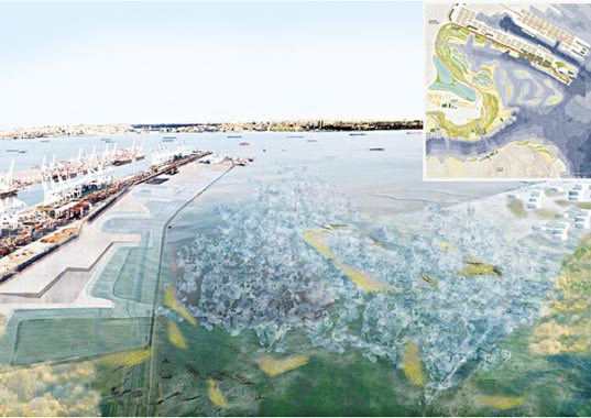
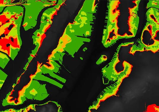
 Some of the higher ground will remain dry and could be used for a new city structure.Designers and engineers re-imagined Jersey city and Liberty Island as water creeps in. They used topographical information to deduce what areas would remain dry and created new city structures around those land masses.10
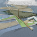 New building shapes were imagined around land that would remain dry.New building shapes were imagined around land that would remain dry.11
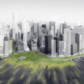
 Much of New York will go under when the water levels rise.The amount of land to be covered by water is dependent on how high the water rises. One thing is for sure though, a lot of New York and New Jersey is low lying and could easily be covered.12
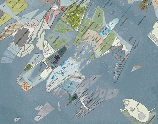
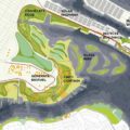 With all this water, shipping should increase.With all of that land now under water comes the need for re-thinking travel. One team imagined increasing shipping to take advantage of the new waterways.13
 An Oyster Farm is imagined in Brooklyn to decrease wave strength and provide food.An oyster farm is imagined in Brooklyn to decrease wave strength and provide food.14
